【評判】Google Earth Engine Mega Course: Remote Sensing Applications
-

-
 本コースの特徴
 -
 受講生の声
受講生の声
講座情報
- ・講師名:Geospatial Training(詳しい経歴はこちら)
- ・作成日:2018-07-24
- ・レクチャー数:18
- ・週間:0記事
- ・月間:0記事
- ・年間:3記事
- ・全期間:3記事
レビュー数
レビュー数の推移
直近6か月以内に本講座のレビューに関して記載された記事はありません。
学習内容
Download, process and visualize various satellite data including Landsat, MODIS, Sentinel and VIIRS
Apply GIS techniques to process and analyze various vector data
Generate various visualizations including time series and histogram charts from remote sensing data
Export various vector data including KML and CSV files
Export images, charts and videos
Learn to perform various image processing including mosaiccing, compositing, zonal statistics, and neighborhood analysis
Classification of satellite data with Machine learning
Master JavaScript programming language to process Earth observations data
Complete a final GIS project on downloading, processing, analyzing and visualizing big data
詳細
Welcome to the Google Earth Engine Mega Course: Remote Sensing Applications. This course is one of the highest-rated courses and most comprehensive Google Earth Engine courses. Even if you have zero programming experience, this course will take you from beginner to mastery.
Here's why:
The course is taught by an experienced geospatial data scientist.
The course has been updated and you'll be learning the latest tools available on the cloud.
The curriculum was developed over five years, with comprehensive student testing and feedback.
The course is constantly updated with new content, with new projects, and modules.
You will have access to example data and sample scripts.
In this course, we will cover the following topics:
Introduction to Earth Engine JavaScript API
Explore Earth Engine
Sign Up with Earth Engine
Basic JavaScript Data Types
Earth Engine Objects
Client versus Server Side Objects
Image Visualization
Filtering Image Collection
Feature Collection
Clipping Images
Import and Export Images
This Google Earth Engine course includes high-resolution video tutorials, example scripts, and other learning resources to help you master the Earth Engine cloud computing platform for remote sensing data processing and analysis. We'll take you step-by-step through engaging video tutorials and teach you everything you need to know to succeed as a spatial data scientist and Google Earth Engine cloud computing expert.
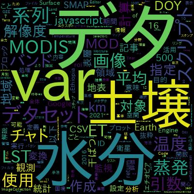
本コースの特徴
本コースの特徴を単語単位でまとめました。以下の単語が気になる方は、ぜひ本講座の受講をオススメします。
受講者の感想
本講座を受講した皆さんの感想を以下にまとめます。
レビューの一覧
・【GEE入門】SMAP衛星データを使って土壌水分の空間分布を可視化、月別時系列分析をCSVで出力[2025-07-18に投稿]
・【GEE入門】MODISの蒸発散量(ET)データを使って時系列分析のグラフ作成[2025-07-16に投稿]
・【GEE入門】MODISの地表面温度(LST)データで時系列分析のグラフ作成[2025-07-10に投稿]